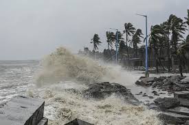
Tropical Storm Francine Threatens Texas and Louisiana with Possible Hurricane Strength by Midweek

A new tropical system, Tropical Storm Francine, formed in the Gulf of Mexico on Monday, and it’s projected to strengthen into a Category 1 hurricane by Wednesday. Francine is slowly advancing towards the Upper Texas and southwestern Louisiana coasts, where it could make landfall later this week.
In response, a hurricane watch has been issued for parts of Louisiana, indicating that hurricane conditions could develop within the next 48 hours. Meanwhile, southern Texas, from Port Mansfield to the Rio Grande, is under a tropical storm watch, with coastal areas likely to experience tropical storm-force winds by Tuesday evening. The watch extends further south along the Mexican coastline to Barra del Tordo.
As of Monday morning, the storm’s center was located roughly 245 miles south-southeast of the mouth of the Rio Grande and about 480 miles south of Cameron, Louisiana. Francine’s winds were sustained at 50 mph, and it was moving north-northwest at a sluggish 5 mph.
This system is the sixth named storm of the 2024 Atlantic hurricane season, following the dissipation of Ernesto on August 20. Francine is also one of three disturbances the National Hurricane Center is monitoring. A second system in the central tropical Atlantic has a 60% chance of becoming a tropical storm within 48 hours, while another, farther east, has the same chance of development over the next week.
Storm Forecast and Potential Hazards
Forecasts indicate that Francine may strengthen into a low-end Category 1 hurricane with winds up to 85 mph by Wednesday. The storm is expected to dump between 4 to 8 inches of rain along the coast, with isolated areas receiving up to 12 inches. This heavy rainfall presents a significant flash flood risk, particularly in northeastern Mexico and along the coasts of Texas and Louisiana.
As Francine moves closer to land, it is anticipated to pick up speed and turn northeast by late Tuesday, influenced by a cold front approaching the Gulf Coast. The storm could be hovering near the Texas coastline by early Wednesday before making landfall, potentially along southwestern Louisiana, according to Donald Jones, a meteorologist with the National Weather Service in Lake Charles, Louisiana.
Jones also mentioned that there is a slight possibility of Francine intensifying further into a Category 2 hurricane. Residents of southwestern Louisiana are being urged to remain vigilant and closely monitor the storm’s progress.
The warmer-than-normal Gulf waters could fuel the storm’s development, providing it with the necessary conditions for strengthening. However, an increase in wind shear and drier air could limit how much the storm intensifies.
According to Jones, areas south of Interstate 10 in southwestern Louisiana could see 8 to 12 inches of rainfall, making flooding the primary concern at the moment. He noted that the storm’s path had shifted slightly eastward on Sunday and could continue to move in that direction, potentially altering the forecasted landfall location.
Residents across the Gulf Coast are advised to stay updated on the storm’s progression as further shifts in the track and intensity are possible in the coming days.


